

 Português
 Ελληνικά
 العربية
Welcome to the Historical Atlas of the Mediterranean
Human civilization began along the large fertile river valleys of the world, such as the Nile, Euphrates, and Ganges. These fresh water rivers allowed crop surpluses to feed a non food producing elite as well as encouraging trade between settlements by easing the flow of goods via riverine transport.
However, once mankind learnt to build boats capable of crossing open water, it was inevitable that civilization would spread via the sea. Being enclosed by three continents, the Mediterranean is a relatively calm sea, a perfect testing ground for mankind’s first seaborne explorers. 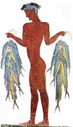
Civilization quickly spread from the Near East to the Greek islands and beyond.
The Mediterranean quickly developed into an important source of commercial wealth for the civilizations of the near east, but it was not long before the Mediterranean itself developed its own complex civilizations.
Being at the cross roads of the three great continents of the old world, the Mediterranean has remained an important focal point of both dialog and conflict between many civilizations.
This site seeks to map the long saga of Mediterranean history through interactive maps, each map holds a wealth of knowledge, by clicking on any map feature you can browse descriptions of important cities or events. Enjoy!
 |
 |
 |
 |